Pansharpening Landsat 8 images
Pansharpening is a process of merging high-resolution panchromatic and lower resolution multispectral imagery to create a single high-resolution image.
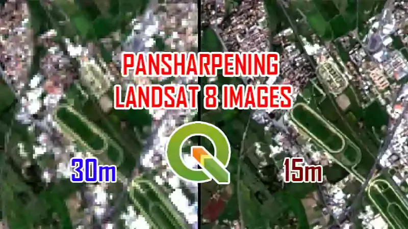
Pan Sharpening Landsat OLI Images: Landsat 8’s Operational Land Imager (OLI) multispectral bands have a spatial resolution of 30m and panchromatic band with 15 m spatial resolution. Pansharpening is ideal for improving the visual clarity of an image for interpretation or digitizing.
PanSharpening Techniques: there are several different methods used to pansharpen or merge images (ENVI, ArcGIS, QGIS, Erdas Imagine). Each method uses a different algorithm.
In this course I will show you how to Pansharpening Landsat 8 images using Semi-Automatic Classification Plugin (SCP).
Landsat OLI (Operational Land Imager) > QGIS > Semi-Automatic Classification Plugin.