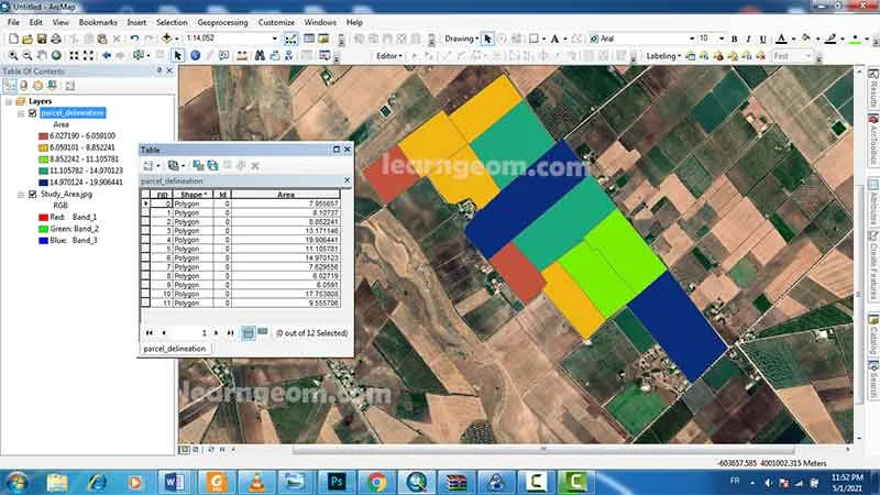
Parcel delineation using ArcGIS

A correct delineation of agricultural parcels is a primary requirement for any parcel-based application.
1. Data: SAS Planet images
SAS Planet is a program designed for viewing and downloading high resolution satellite imagery and conventional maps submitted by such services as Google Maps, Open Street Map, Bings Maps...
2. Auto-Complete Polygon
With Auto-Complete Polygon, you can digitize a new polygon that adjoins an existing polygon, using the existing polygon's geometry and the edit sketch to define the edges of the new polygon.
3. Parcels delineation
Currently, high resolution remote sensing images provide useful spatial information to delineate parcels. Using satellite imaging can be a scalable and cost effective manner to perform the task of farm parcel delineation to collect this valuable data. Parcel delineation provides cadastral data that is important in managing of land.
4. Land status
Determining the land status of a particular parcel of land can be very simple or extremely complex. Land status is a term used to describe the specifics of ownership regarding a certain parcel of land.